
Several parts of Mumbai received heavy rainfall in the last 24 hours, with Vikhroli reporting the highest downpour. The IMD reported significant rainfall in various areas of the city.

According to an IMD forecast issued on Thursday, a heatwave spell will persist over northwest and central India during the next five days and over east India during the next three days.
Monsoon is likely to be 96 per cent of the long period average

Palghar, Thane, Raigad and Ratnagiri could witness thunderstorm activity, lightning, moderate rain and gusty storm over the next two days.

The maximum temperature at the Safdarjung Observatory, Delhi's base station, is likely to rise to 45 degrees Celsius.

The mercury in Delhi, which recorded its hottest day of the year so far at 45.6 degrees Celsius on Sunday, came down to 42.4 degrees Celsius, according to the India meteorological department.

The weather office on Monday forecast heavy to very heavy rainfall over the next three days over some parts of Uttarakhand, which is still recovering from a deluge last week that is feared to have taken over 1,000 lives.

The situation in fact is not that worrying for Thursday and IMD regional director Ganesh Das said the rain is expected to be "light and moderate".

The state broadcasters have started the practice, but private news channels may follow suit, a ministry source said.

India is set to experience extreme heat during the April to June period, with the central and western peninsular parts expected to face the worst impact, the IMD said on Monday as the country prepares for seven-phase general elections from April 19.

After churning across the Arabian Sea for more than 10 days, Biparjoy made landfall near Jakhau Port in Gujarat on Thursday.

The four-month monsoon season from June to September accounts for 75 per cent of rainfall in the country.

'The intensity and frequency of heatwaves will be much higher than in previous years over Punjab, Haryana, Rajasthan, Gujarat, Madhya Pradesh and Odisha.'

It expects rainfall to be about 106 per cent of the long period average, aided by La Nia conditions anticipated to play a role in the second half of the monsoon season.

The India Meteorological Department has issued an 'orange' alert.

India has received 20 per cent less rainfall since the start of the monsoon period on June 1, with the rain-bearing system making no significant progress between June 12 and 18, according to the India Meteorological Department (IMD).

The BCCI press conference scheduled at 1.30pm in Mumbai is 'expected to be delayed owing to weather disruptions'.

The onset of the southwest monsoon is being keenly watched this year as it may provide an early sign regarding its progress over the Indian subcontinent, particularly when El Nio is expected to rear its head during the latter half of the season.

Temperatures are likely to remain in a similar range until Thursday, with a gradual fall expected from June 13.

The system, which moved towards Bangladesh from north Bay of Bengal at a speed of 56 kmph caused moderate to heavy rain and squally weather in West Bengal's coastal districts of South 24 Parganas, North 24 Parganas and Purba Medinipur, dampening festive spirits on Deepavali and Kali Puja.
The minimum temperatures are very likely to fall by 2-5 degrees Celsius over most parts of East India, Central India over the next two-three days, while the spell of intense cold can extend beyond that in the Northwest part of the country.

Scores of people die every year due to cold waves that sweep across the north Indian plains.

India now faced a higher likelihood of a drought in some parts, as monsoon rain would be less than predicted in April, private weather forecaster Skymet said on Friday.

The Indian Meteorological Department has issued a forecast predicting significant precipitation in the city throughout the week, casting a shadow over the series opener.

Skymet is credited with correctly predicting the 2009 drought.

Contrary to some predictions, rainfall is adequate so far.

As the Northeast monsoon intensified across Tamil Nadu, the regional weather office issued heavy rainfall alert to a number of districts. Chief Minister M K Stalin reviewed the situation and directed precautionary measures.
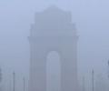
The India Meteorological Department (IMD) reported that very dense fog began forming around 5.30 am, resulting in a thick haze over different parts of the national capital.

Sowing had started on a sluggish note in several parts of the country because of delay in the onset of the monsoon but has picked up pace subsequently as the rains progressed and performed appreciably well in August.

Weather scientists attribute the early onset of southwest monsoon over Kerala to the influence of the remnants of cyclone Asani that triggered the cross-equatorial flow, a key factor for the seasonal rains.

After becoming active over the rice-growing Indo-Gangetic plains, the southwest monsoon might witness weak phase for the next 3-4 days over the already rain-deficient region. So far, the main deficit states are Uttar Pradesh (-42 per cent), Bihar (-36 per cent), Jharkhand (-48 per cent), and West Bengal (-24 per cent). According to private weather forecasting agency Skymet, rains in west UP, Punjab, Haryana, Bihar, and Jharkhand are expected to be weak in the next 3-4 days before again picking pace.

Mercury hovered around 40 degrees Celsius in large parts of the country on Monday as the Indian meteorological department predicted heat wave conditions in parts of east India over the next four days and the northwest region over the next two days.

If Jatin Singh is right in the long run and his morphed business can help reduce farmer distress, Skymet will provide a service of far more value from where it began

This piece of forecast from the India Meteorological Department and the European Centre for Medium-Range weather Forecasts may bring cheer to Indian farmers

The BMC declared a holiday for all government and private schools and colleges in Mumbai on Thursday after the IMD issued a 'red' alert for the metropolis.

A depression over the southeast Arabian Sea, south of Porbandar in Gujarat, is likely to move northwestward and intensify into a cyclonic storm, the India Meteorological Department said on Tuesday.

A steady drizzle in the evening brought premature end to evening practice sessions of Kolkata Knight Riders and Royal Challengers Bengaluru on the eve of their IPL 2025 opening match on Saturday.

The Met office had said Monday that significantly higher-than-normal temperatures may have an adverse impact on wheat and other crops.

The weather department said its latest model analysis had indicated that the moist easterly winds in the lower level from the Bay of Bengal would spread to northwest India, covering Punjab and Haryana by July 10, leading to the advancement of monsoon and an increase in rainfall activity over the region, including Delhi, from July 10 onwards.

Rainfall in August is predicted to be below normal (less than 94 per cent of LPA), but the situation is expected to improve comparatively in September, the IMD said.
